

Complete Docking Guide & Island Information
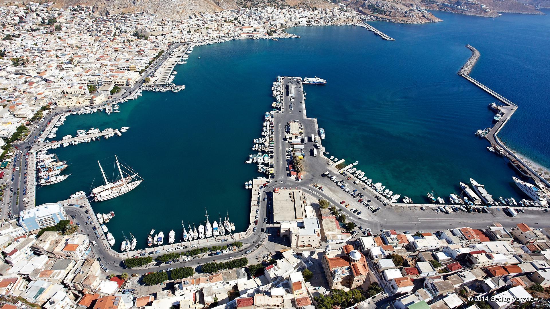
The port of Kalymnos, the famous Desires, is the main port and the capital of the island. Kalymnos, world-famous for its history in sponge fishing, is one of the most densely populated islands of Greece, with a population of 16,253 inhabitants (2001 census). Pothia is a busy and picturesque port that serves daily passenger ships of all categories, as well as large trucks.
- Main Peaks: Prophet Elias in the center of the island (760 m.), Kyra Psili or Karapsili in the southeast (700 m.) and Galatiani in the northwest.
- Coastline & Bays: The coasts are steep, forming beautiful bays such as Rineas, Pezonta, Paleonisou Bay, Emporios, Linaria and Pithari.
- Around the Islands: Kalymnos is surrounded by a multitude of islets, such as the habitable Telendos, the Pserimos (the largest), Plati, Kalolimnos, Imia, Glaronisia, Kalavros, Nera, Agios Nikolaos, Agios Andreas and Pitta.
Kalymnos has an area of 109 sq. km. and is characterized by mountainous and rocky terrain with some small plains.
The road network of Pothia and the surrounding settlements is modern, safe and includes major regional roads.
General Information & Geography of Kalymnos
Maritime Information & Port Services in Pothia
The port of Pothia offers excellent accommodation opportunities for sailboats and pleasure boats (capacity up to 150 boats).
Coordinates (Google Maps)
- Latitude & Longitude: 36°56.9′N, 26°59.6′E
Weather Conditions & Approaches
- Protection: It provides good protection from the meltemi, although strong gusts of NW winds are noted upon approach and within the harbor.
- South Winds: When southerly winds blow, strong swells are created.
Anchorage & Mooring Options
- Southwest Quay (SW Quay):
- Capacity: 12-15 boats (stern mooring).
- Tufting depth: 7.0 – 8.0 meters.
- Bottom: Mud and weed – very good grip once the anchor is set.
- Note: Check the anchor hold as the meltemi is hitting your left bow.
- New Northwest Quay (NW Quay – North of the fishing basin):
- Depth at the pier: 3.0 – 3.5 meters.
- Tufting depth: 6.0 – 7.0 meters.
- Advantage: Safer option when the meltemi is very strong, as the wind comes from the stern.
Amenities: Water and electricity connections are available at both piers.
Nautical Charts & Communication
- Nautical Charts:
- NOT: 2682 (Kolpos Patalion to Nisos Nisiros)
- Imray-Tetra: G34 (Southern Cyclades)
- WHAT: 54407 (Nisos Kalymnos to Kadriga Burnu)
- Greek: 451 (Leros to Rhodes)
- Communication Channels:
- Kalymnos Coast Guard: VHF Channel 12 | Tel: +30 2430 28 137
- Olympic Radio: There is no signal.
Brief History of Kalymnos
- Prehistory & Antiquity: Kalymnos has been inhabited since the Neolithic era. The first inhabitants were the Carians (ruins in Kastella) and later the Phoenicians (ruins in Emporios).
- Dorians & Trojan War: Between 1150 BC – 800 BC it was settled by Dorians (led by Thessalus, son of Heracles). Homer mentions the island as ‘Kalydnes’, participating in the Trojan War with 30 ships. After the war, shipwrecked Agamemnon built Argos.
- Classic Era & Alliances: It was an autonomous democratic state with a ‘Damos’ (Church of the People). After the Persian subjugation, it was liberated in 477 BC and joined the Athenian League. It was subjugated to Mausolus of Halicarnassus in 357 BC, but regained its freedom.
- Roman, Byzantine & Modern Period: It was conquered by the Romans, Byzantines, Venetian Knights of St. John (14th century) and Ottomans (1522). In 1912 it came under Italian occupation, while the formal integration with Greece took place on March 7, 1948.